

Recreation around SLO
Coastal activities
San Luis Obispo, located in Central Coast California, with its rocky hills offers great opportunities for a half- or day hike as well as jogging opportunities.
Most hikes listed are accessible directly from the city border in walking distance, and due to its rather moderate steepness degree, can be jogged as well.
Many trails are also great for (downhill) biking.
Bikes can be rented here.
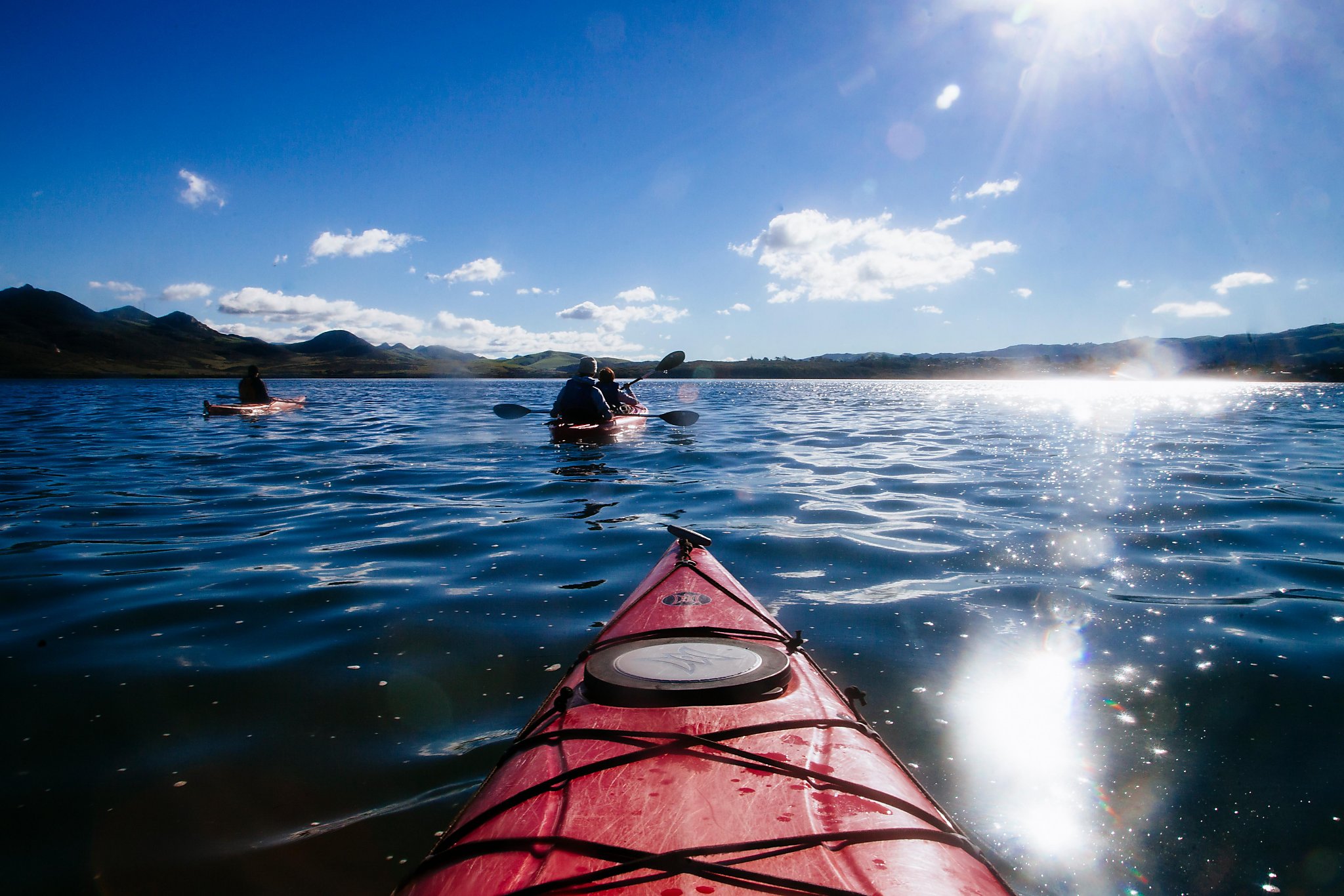
There are many more activities, such as hiking, kayaking or boating on the coast, approx. 10 miles away but require driving per
regional transit bus line 12
to Morro Bay and Los Osos or line 10 to Shell Beach and then
Avila Trolley, or by rental car.
![]() This symbol indicates a google map link, click it to open the location in your map application an show you directions.
This symbol indicates a google map link, click it to open the location in your map application an show you directions.
|
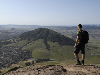
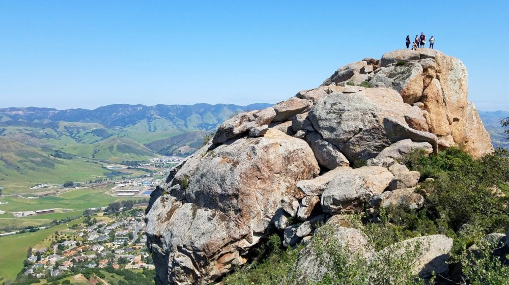
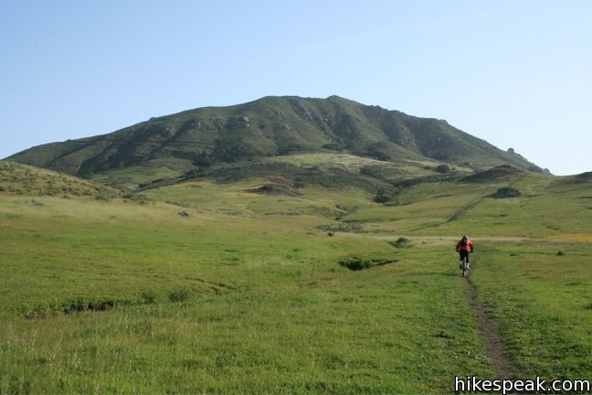
Bishop Peak Sometimes called Bishop’s Peak, but more formally known as Bishop Peak, this mountain is the most sought after summit in San Luis Obispo. Bishop Peak is the tallest of the Nine Sisters, the picturesque volcanic Morros stretching across San Luis Obispo. Distance: 3.5 to 4.2 miles (out and back) Hiking time: Approx. 2 hours Activity: hiking Directions, hiking info and map |
 |
|
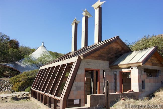
Architecture Graveyard Bring a camera to snap some pictures of the 15 design projects of former architecture and engineering students. Distance: 2.5 miles (out and back) Hiking time: Approx. 2 hours Activity: hiking Directions, hiking info and map |
 |
|
Cal Poly "P" The "P" is a 50-by-30 foot landmark located atop a northwestern hill of California Polytechnic State University, San Luis Obispo, California. Its creation dates back to the early 1900s and it has remained on the same hillside ever since. Distance: 0.5 miles (out and back) Hiking time: Less than 1 hour Activity: hiking Directions, hiking info and map |
 |
|
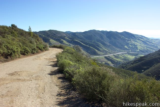
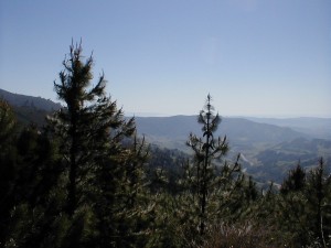
Cuesta Ridge Botanical Area - Los Padres National Forest Discover a tucked-away oasis of Sargent cypress straddling a ridge in the Santa Lucia Mountains north of San Luis Obispo. The evergreens are accompanied by coastal views that could have you imagining you’re somewhere farther north in California. Distance: 6 miles (out and back) Hiking time: Approx. 3 hours Activity: jogging, hiking, biking Directions, hiking info and map |
 |
|
Poly Canyon Above Stenner Creek Road near the Cal Poly Campus, a freestyle bike course is hidden within a eucalyptus grove. The easiest route to The Eucs is to head up and back on Stenner Creek Trail. For a longer hike that explores neighboring grassland on slopes below the Santa Lucia Mountains, consider this 4.25-mile loop with 550 feet of elevation change. Distance: 4.25 miles (loop) Hiking time: Approx. 3 hours Activity: jogging, hiking, biking Directions, hiking info and map |
 |
|
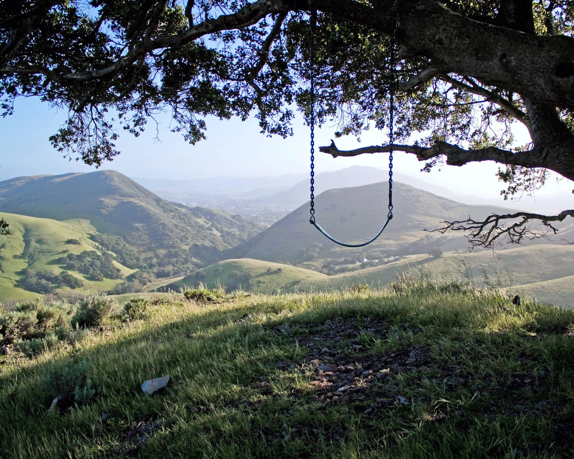
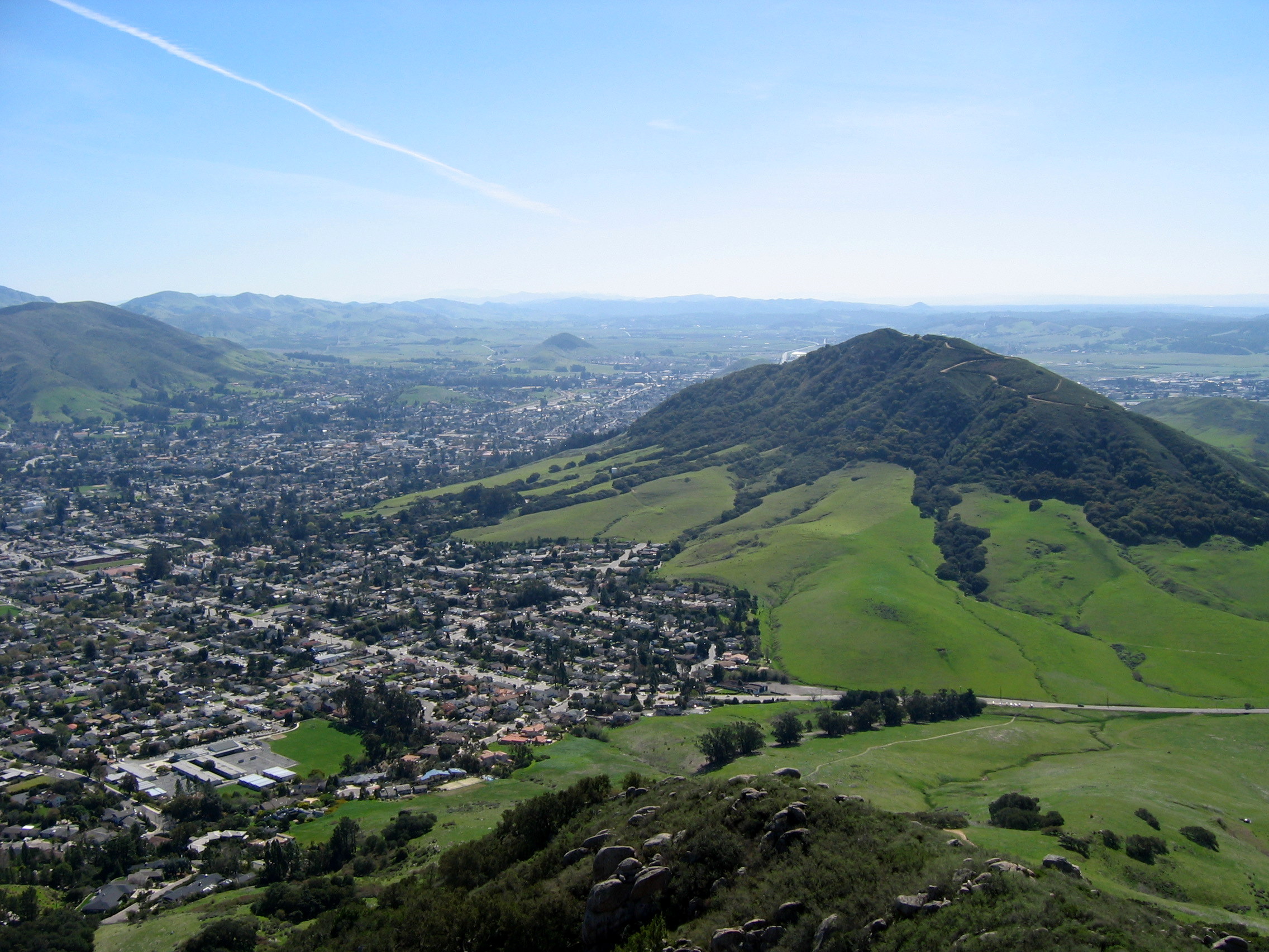
San Luis Mountain Located just west of downtown San Luis Obispo, the 1,292-foot Cerro San Luis (or San Luis Mountain) offers sweeping views over the city and surroundings. Its accessible through several directions, check out the map. Distance: 4 miles (out and back or loop) Hiking time: Approx. 2 hours Activity: jogging, hiking, biking Directions, hiking info and map |
 |
|
Laguna Lake Park to Cerro San Luis Laguna Lake Park lies south of Cerro San Luis. This 375-acre park includes a 25-acre lake and several hiking trails. Distance: 5.7 miles (out and back or loop) Hiking time: Approx. 3 hours hike Activity: jogging and biking, easy hike Directions, hiking info and map |
 |
|
East Cuesta Ridge Views from the trail extend over San Luis Obispo and its surrounding peaks toward the ocean to the west at Morro Bay and to the south by Oceano Dunes. Distance: 8.4 - 10.2 miles (out and back or loop) Hiking time: Approx. 4 hours hike Activity: jogging, biking, hiking Directions, hiking info and map |
 |
|
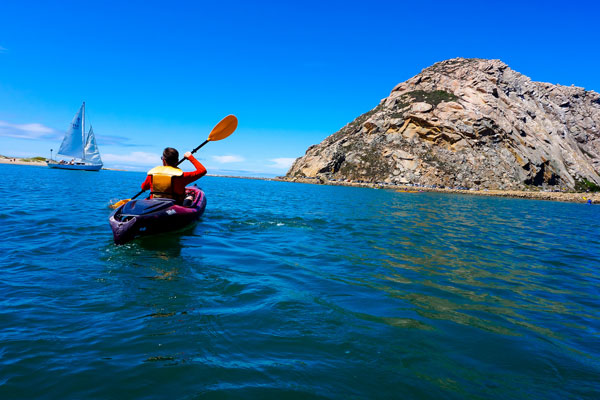
Kayak Horizons Kayak Morro Bay from the waterfront. Lots of free parking right outside and a location that makes paddling to all the interesting sites easy and fun. They have a large rental fleet featuring Old Town and Necky Sit-In Kayaks. 551 Embarcadero, Morro Bay, CA 93442 kayakhorizons.com +1 805 772-6444 |
 |
|
A Kayak Shack Kayak Shack offers different sized kayaks for reasonable rent as well as tours around Morro Bay. 551 Embarcadero, Morro Bay, CA 93442 morrobaykayakrental.com +1 805 772-8796 |
 |
|
Avila Beach Paddlesports Avila Beach Paddlesports is popular with visitors and locals alike. It's friendly neighborhood paddling shop dedicated to kayak and stand up paddleboard (SUP) rentals, lessons, and eco-friendly Adventure Tours that cater to all abilities. 3915 Avila Beach Dr, Avila Beach, CA 93424 avilabeachpaddlesports.com +1 805 704-6902 |
 |
|
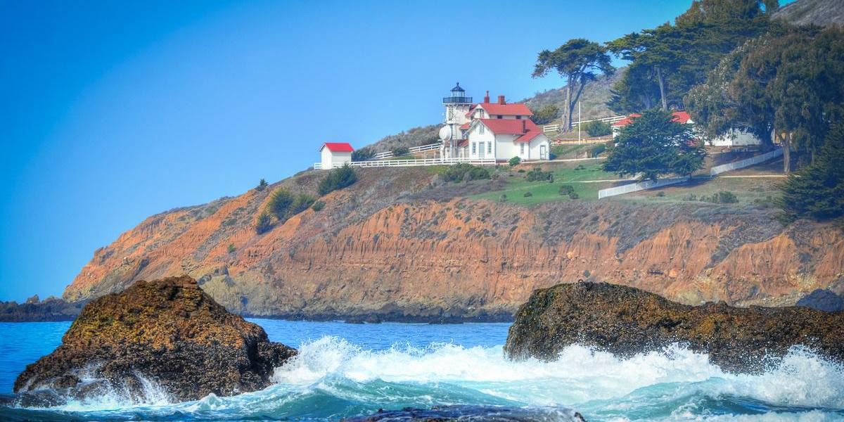
Pecho Coast Trail (to Point San Luis Lighthouse) The Pecho Coast Trail is located on the south end of PG&E property and accessed through Avila Beach. Choose from two guided hikes, the 3.75-mile roundtrip hike to Point San Luis Lighthouse and the 8-mile roundtrip hike to Rattlesnake Canyon. Location: Avila Distance: 4 miles + 8 miles (out and back) Hiking time: Approx. 2 - 5 hours Activity: hiking Directions, hiking info and map |
 |
|
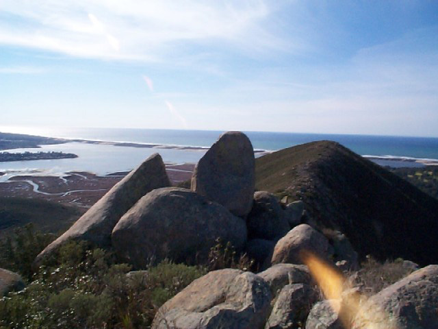
Cerro Cabrillo and Tiki Rock The summit of Cerro Cabrillo is the highest point in Morro Bay State Park, offering panoramic oceanfront views. The unmaintained trail to the summit passes Tiki Rock, an unmistakable boulder near the top of the peak resembling those carved by Polynesians. Location: Morro Bay Distance: 2.5 + 2 (getting there) miles Hiking time: Approx. 2 - 3 hours Activity: hiking, biking Directions, hiking info and map |
 |
|
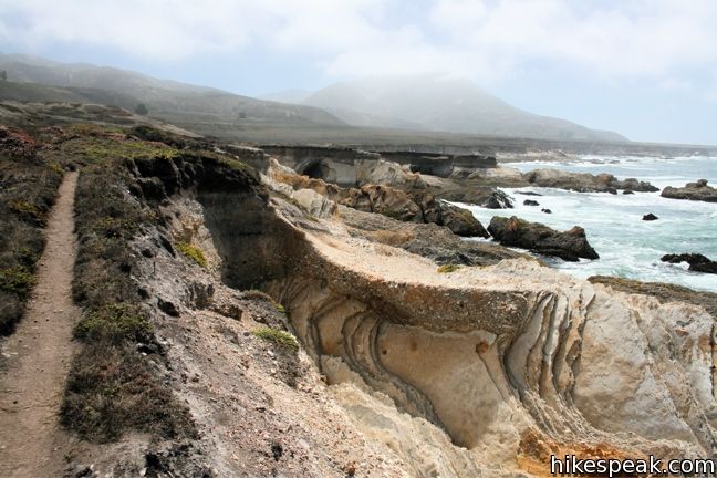
Bluff Trail Montaña de Oro State Park preserves 8,000 acres along the picturesque coast of San Luis Obispo County. The dramatic shoreline and thousand-foot mountains provide scenic setting for a host of great trails. Location: Los Osos Distance: 3 miles (out and back) Hiking time: Approx. 2 hours Activity: jogging, hiking, biking Directions, hiking info and map |
 |
|
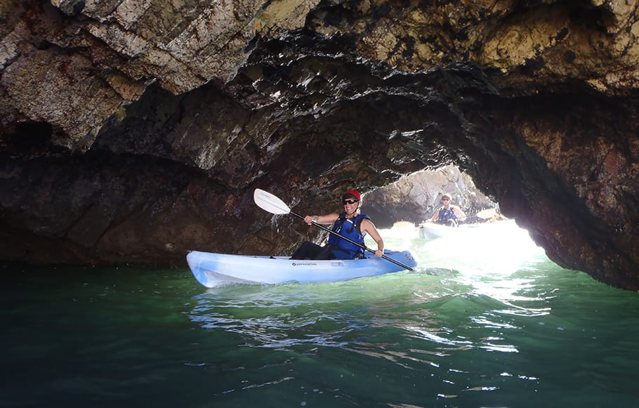
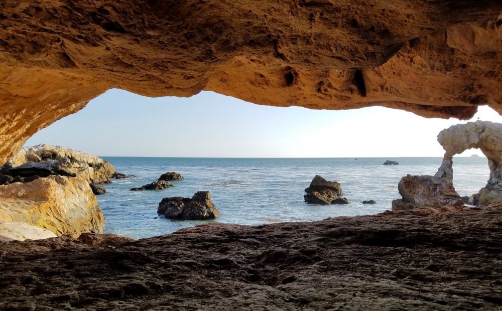
Cave Landing (Pirate’s Cave) This half-mile round trip hike visits a small rock bridge at the end of a dramatic headland east of Avila Beach. The hike down Cave Landing to the natural tunnel sometimes called Pirate’s Cave provides outstanding coastal views over the beach cities of San Luis Obispo County. Location: Avila Distance: 0.5 miles Hiking time: place to visit Activity: visit, photos Directions, hiking info and map |
 |